Overview
GREENGAGE was a three-year pan-European Horizon Europe project designed to support sustainable urban development by helping public authorities shape climate mitigation and adaptation policies by actively involving citizens in the co-creation of green initiatives.
Andrii Khrystodulov supported GISAT by proving the expertise with Earth Observation domain and sustainable urban development practices using Copernicus products and services to support project pilots.
The result of 3 year project has two major contribution baselines:
- Consulting the project pilots and shaping the right tools to empower pilot’s citizen with data they can use to communicate with policy-makers;
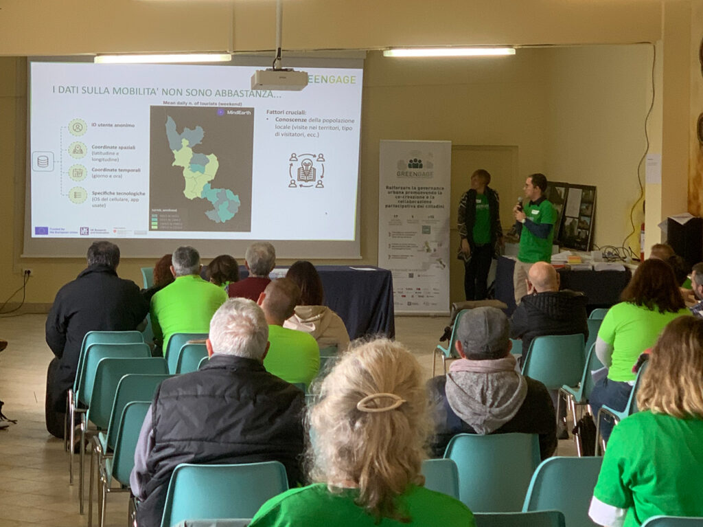
- Project management, technical communication and delivery of the interpreted result through web-based interactive application that combines citizen-collected data via IoT sensors, and Copernicus analyzed data as a contextual layer to understand the broader picture.
Context and scale
The main area of contribution relevant to Khrystodulov Consult was the development of more effective and sustainable urban development approaches supported by Copernicus programme. GREENGAGE included four pilot regions across Italy, the United Kingdom, Denmark, and the Netherlands, each with its own context, priorities, and operational challenges. In this setting, citizen science served as a powerful instrument for collecting data at scale, while Remote Sensing provided the wider regional, and national context needed to strengthen the interpretation and practical value of in-situ observations.
Remote Sensing analytical outputs contributed to three main thematic areas:
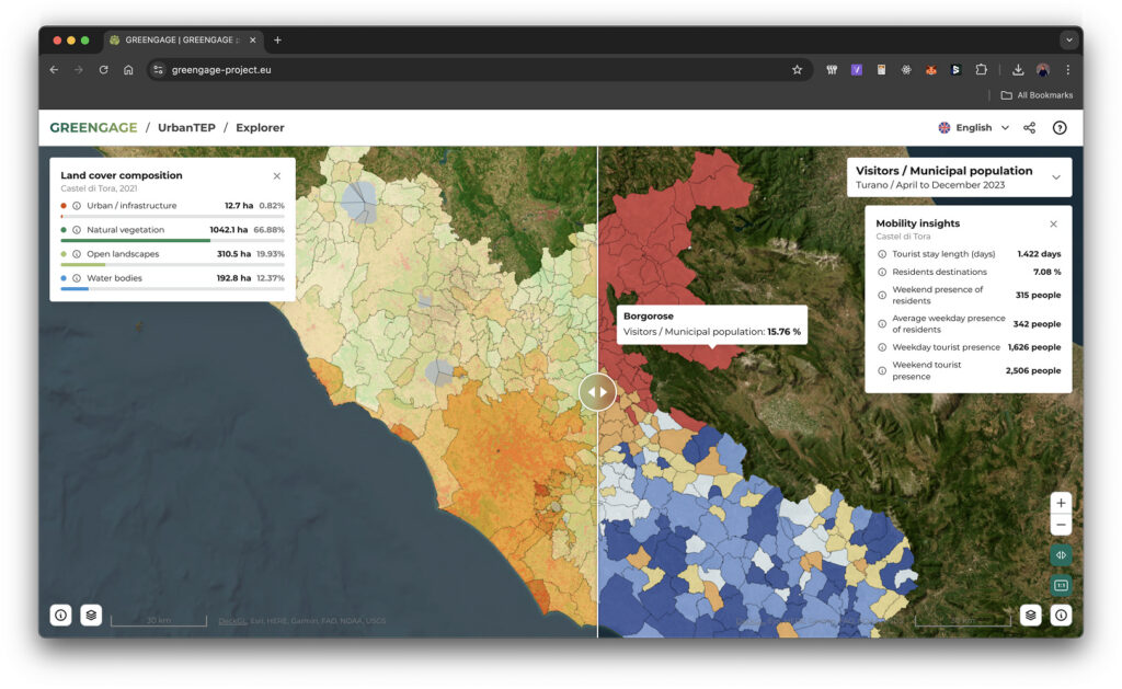
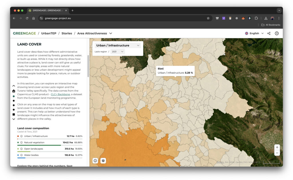
- Mobility – Analysing how tourists and residents move across cities, and how land cover and land use may shape those patterns, including whether recreational areas and natural landscapes attract people away from large urban centres toward more rural yet appealing locations.
- Air quality – Combining citizens’ IoT sensor measurements with Copernicus Sentinel-5P data to understand the broader environmental context and examine how subjective perceptions of good or poor air quality relate to measured conditions. Understanding NO2, CO2, Methane, and VOC patterns.
- Area attractiveness from tourism and local quality-of-life perspectives – Interpretation on land use, land cover and air quality patterns, monitoring changes and empowering citizens observatories with ready-to-use tools to support communication with policy-makers.
Role and delivery
Within GREENGAGE, the contribution relevant to Khrystodulov Consult combined Copernicus and geospatial consultancy, active participation in shaping project narratives, and practical delivery work aimed at making satellite-based insights more understandable and usable for pilot contexts. A key part of the role was helping pilot teams understand both the opportunities and the limitations of Copernicus products and services, ensuring that expectations remained realistic while the value of Earth Observation was communicated clearly and credibly.
Alongside this consultancy and coordination work, Khrystodulov Consult contributed to the development of an open-source visualisation application built on top of GISAT’s framework. The application was designed as a user-friendly web application that allowed non-expert users to combine datasets such as citizen-collected information (Volatile Organic Compounds measurements) and processed satellite insights into a more powerful and accessible decision-support environment. This helped bridge the gap between technical geospatial analysis and the practical needs of end users working in pilot and policy-facing settings.
The delivery scope covered research, preparation of results, and adaptation of outputs to pilot-specific needs, while also supporting broader project management across technical and non-technical stakeholder groups. This included helping integrate diverse data flows, maintaining alignment between analytical outputs and stakeholder expectations, and contributing to the development of a sustainable tool that could remain useful beyond the immediate project itself and support future initiatives.